360gigapixel_logo_2017_500px360gigapixel_logo_2017_500px360gigapixel_logo_2017_500px360gigapixel_logo_2017_500px
  • ABOUT US
  • PROJECTS
  • SOLUTIONS
  • CONTACT
✕

Szolnok – Aerial Panorama map

  • Home
  • PROJECTS
  • 360 Panorama
  • Szolnok – Aerial Panorama map

Szolnok – Aerial Panorama map

Published by 360gigapixel@gmail.com at October 29, 2014
Categories
  • 360 Panorama
  • Aerial
  • DateOctober 29, 2014

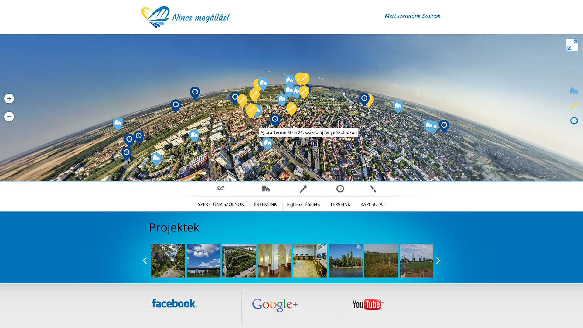
A drone took 360-degree aerial pictures in Szolnok to show the public all the planned city developments. According to the city development plans a lot of tourism-related infrastructure will be built. Our gigapixel-sized solution is creating a new navigation surface, which explains the future of the city in detail. As a result of the innovative campaign the new developments were highly recognised by the inhabitants and by the potential tourists. This success was also used by the political campaign of the mayor.

The project won the "City Marketing Diamond" prize of the Hungarian Marketing Association in 2015.

Client:

t.

Szolnoki Városfejlesztő Nonprofit Zr

Date:

May 2014

Website:

View website

szolnok

Related

Related posts

February 14, 2018

Vienna Tourist Board – Wiener Moderne


Read more
February 14, 2018

Milka Waves – VR roller coaster


Read more
April 15, 2017

HBM – 360 PANORAMA


Read more
August 21, 2016

PH35 – Gigapixel Panorama


Read more
360 GIGAPIXEL - Aapril Kommunikációs Kft. | Icons made by Freepik from www.flaticon.com